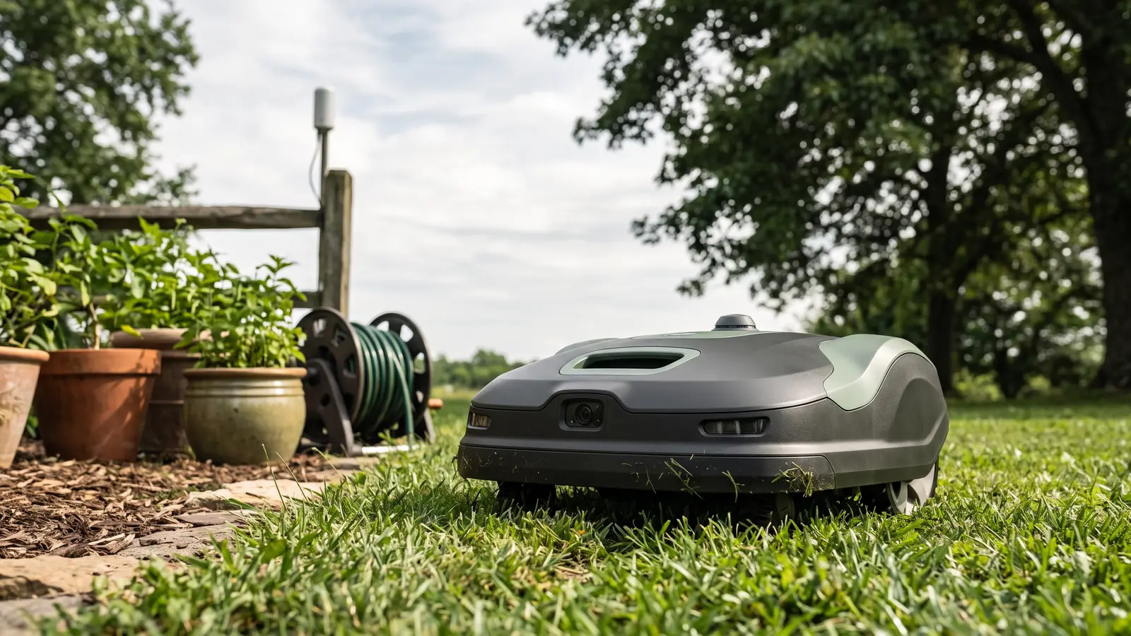
RTK vs LiDAR vs Vision: How Wire-Free Robot Mowers Navigate
Every wire-free robot mower on the market answers one question a thousand times an hour: where am I, exactly? The old answer was a buried boundary wire — dumb, reliable, and the product’s most hated component for twenty years. The new answer is one of three sensing systems, or a fusion of them: RTK (satellite correction), LiDAR (laser mapping), and vision (cameras). Which system a mower leads with is the single most important fit decision in the category — more than brand, more than price — because each one fails differently, and the one that fails on your lawn is the one that matters.
The problem navigation has to solve
A robot mower needs to know three things continuously: its position (to stay inside the virtual boundary and mow in systematic lines instead of random wander), its obstacles (to stop, steer, and resume without drama), and its edges (where grass becomes bed, fence, or driveway). No single sensor does all three well in all conditions — which is why the spec fight exists. Each system’s strengths map cleanly onto different yards.
RTK: surveying equipment, miniaturized
RTK (real-time kinematic) positioning is GPS with the wobble removed. A reference station — a small antenna in your yard, or a networked correction service over the internet — supplies error corrections that sharpen satellite fixes from meters to centimeters. That is the same trick surveyors use, and it’s why an RTK mower can cut clean, parallel, repeatable lines like a machine on rails.
What it needs from your yard: open sky. Satellite correction degrades under dense tree canopy and against tall structures. If your lawn is a meadow ringed by woods, RTK alone will drift at the edges.
What it costs you: a one-time antenna placement (on RTK-referenced setups) with a clear view of the sky, and an occasional check that correction is healthy in your area — network RTK coverage is excellent in populated regions and thinner at the ends of the map.
The tell in listings: “RTK”, “EFLS” (Navimow’s branding), “NRTK/NetRTK” (networked correction, no yard antenna), “centimeter-level positioning”.
LiDAR: the map that ignores the sky
LiDAR spins a laser and measures returns, building a precise geometric map of the yard from the trees, fences, walls, and beds themselves. It needs no satellites, no sky-view, and no light — which makes it the canopy-proof system and the one that works identically at noon and at dusk.
What it needs from your yard: structure. LiDAR maps the world by bouncing off it; a featureless open lawn with no boundaries in laser range is its weak case (rare in practice — there’s always a fence, a house, a bed edge).
What it costs you: the turret hardware is real money, which is why LiDAR-first machines cluster at the flagship end. And a LiDAR map is geometry, not meaning — it knows something is there, not what, which is why LiDAR machines pair with cameras.
The tell in listings: “LiDAR”, “360° 3D LiDAR”, “dual-LiDAR”, “OmniSense”, “dual-vision assist”.
Vision: the last meter
Camera systems classify what the other sensors localize. Grass versus not-grass, a hose versus a hedgehog, a child versus a statue — vision is the system that makes a robot safe and civilized around the things a lawn actually contains. Modern stacks recognize hundreds of object classes, and vision doubles as a positioning aid where both satellite and laser signals soften (along walls, under individual trees).
What it needs from your yard: light and reasonable contrast. Pure-vision navigation weakens in darkness and gets busy in dappled, fast-changing shade — which is why essentially nobody sells a vision-only flagship anymore. Vision is the complement, not the foundation.
The tell in listings: “AI vision”, “VisionFence”, “UltraSense”, “AIVI 3D”, “object recognition”.
Fusion: what flagships actually do
The 2026 flagship pattern is to run two or all three systems simultaneously and let the strongest signal carry the moment:
| System | Works under canopy | Needs sky | Needs structure | Cost class | Best paired with |
|---|---|---|---|---|---|
| RTK | Weakly | Yes | No | Mid | Vision |
| LiDAR | Yes | No | Yes | High | Vision |
| Vision | Partially | No | No | Low–mid | RTK or LiDAR |
Mammotion’s LUBA 3 runs all three (they brand it Tri-Fusion). Dreame’s A3 pairs LiDAR with dual vision. Navimow’s line pairs RTK with vision throughout. Nobody asks you to choose blind — but knowing which leg is load-bearing on your lawn is how you avoid paying for the wrong tower.
The 60-second yard diagnosis
- Stand where the mower will charge. Can you see wide-open sky in most directions? Yes → RTK-plus-vision is your value pick. No → you’re shopping LiDAR-first.
- Walk your worst tree. If a mower-sized patch of your lawn spends the day in full shade under canopy, that patch is where a satellite-only robot will drift. Test the category’s honest question: how much of the lawn is like that?
- Count the living obstacles. Kids, dogs, garden hoses moved daily, a neighbor’s cat with no fear → vision’s classification is not optional; insist on a fused stack.
- Match the model to the finding:
Buy this if…
Open sky, moderate terrain — RTK+vision machines like the Navimow line are the simplicity and value sweet spot.**Canopy or dense structure — LiDAR-first machines like the Dreame A3 and LUBA 3 hold position where satellites soften.**Everything at once — slope plus trees plus zones — buy fusion: LUBA 3’s Tri-Fusion is built for exactly that stack.
Skip this if…
A featureless open lawn at the far edge of network-RTK coverage — check correction availability before assuming RTK will carry you.**Full shade on most of the lawn and a vision-only budget machine — that combination produces the drifted-boundary complaints in owner threads.**Acreage near a machine’s rated ceiling under hard conditions — buy the trim with headroom; navigation can’t fix an undersized rating.
Consider instead if…
Still deciding whether a robot fits at all — robot vs walk-behind prices both paths honestly.**Want the whole field ranked by yard size first — the best-by-yard-size guide is the site’s verified field.
A floor demo of a fused flagship navigating by camera, satellite, and laser — the systems in this article, working together:
FAQ
Do wire-free robot mowers need boundary wire at all?
No. Every machine covered on this site maps the lawn virtually — you walk the boundary once in the app, and the mower enforces it electronically. The wire era’s trenching, splicing, and break-finding is what this generation deleted.
Which navigation system is best for a yard with lots of trees?
LiDAR-first. It positions from laser returns off the trees and structures themselves, so canopy doesn’t starve it the way it starves satellite correction. RTK-plus-vision handles scattered trees fine; canopy-defined lawns are LiDAR territory.
What happens when an RTK mower loses signal under a tree?
It slows, falls back to its secondary system (usually vision) for local positioning, and either works through or pauses until correction returns. Fused flagships — which add LiDAR — keep working through the gap. It degrades gracefully; it’s a coverage question, not a crash.
Is vision alone enough — some robots are camera-only and cheaper?
Camera-only machines exist at the budget end and work on simple, well-lit lawns. The weaknesses are darkness, dappled fast-changing shade, and low-contrast edges. Most buyers are better served by RTK-or-LiDAR as the foundation with vision as the assistant.
Does network RTK need an antenna in my yard?
Not always — network RTK (NRTK/NetRTK) delivers corrections over the internet, no yard antenna, though coverage varies by region; classic RTK uses a small reference antenna you place with clear sky view. Check the specific model’s current setup requirements for your area before buying — this is the category’s fastest-moving spec.